Most people only see the Northside of Jacksonville on their way to catch a flight.
Driving up Interstate 95 toward the airport, the dense suburban grids and commercial strips of the city eventually give way to massive expanses of pine, hardwood hammock, and coastal marsh. It is easy to look out the car window and assume this is simply undeveloped land on the outskirts of town, waiting for the next developer to buy it and pave it.
It is not waiting.
The single most defining feature of the Northside is a 46,000-acre national preserve sitting inside the city limits. It is protected, it is permanent, and it is the reason that this quadrant of the city will never look like the others. When someone tells us they want to buy in Jacksonville but they need actual space between their house and the next one—real acreage without crossing the county line—this is where we point them.
Here is how the Northside actually works, what the protected landscape dictates about the housing, and the private infrastructure you are going to have to manage yourself if you buy out here.
New to the city? Start with our guide to living in Jacksonville, then come back.
The Boundaries and the Preserve
The Northside is massive. It covers everything north of the urban core up to the Nassau County line. It encompasses the residential concentrations of Oceanway, the industrial and logistics corridors near the airport, and stretches east across the coastal marshes all the way to the Atlantic Ocean.
What defines the real estate out here isn't what has been built, but what cannot be.
The Timucuan Ecological and Historic Preserve covers 46,000 acres of salt marsh, wetlands, coastal dunes, and hardwood hammock. Authorized by Congress in 1988 and managed by the National Park Service in cooperation with the City of Jacksonville and Florida State Parks, this is a genuinely major piece of protected landscape sitting inside a major city's limits.
The preserve is the reason large stretches of the Northside will never be subdivided. It dictates the map. (It even reaches outside Duval County—the NaNa Dune at American Beach on Amelia Island, the tallest dune in Florida, is an NPS-owned unit of it, preserved largely through the efforts of MaVynee Betsch).
A remarkable number of lifelong Jacksonville residents have never set foot in any of it.
What is Actually Out Here
Beyond the protected marshlands, the Northside holds a heavy concentration of the city's major infrastructure and history.
Jacksonville International Airport anchors the western edge of the area. If you travel heavily for work, airport proximity is a genuine quality-of-life factor. The difference between a ten-minute drive to the terminal from an Oceanway subdivision and a highly unpredictable hour-long slog from the southern suburbs changes how you live.
Just east of the interstate sits River City Marketplace, a sprawling open-air commercial complex that serves as the retail anchor for the entire northern edge of the city. Grocery runs, dining, and daily errands are handled here, meaning you do not have to drive into the urban core for necessities.
Down on the Trout River sits the Jacksonville Zoo and Botanical Gardens.
The History on the Islands
If you follow Heckscher Drive east toward the coast, you hit the sea islands, which hold the area's most significant historical sites.
Fort George Island is the centerpiece. It holds Kingsley Plantation, an active National Park Service site that bluntly documents the history of the enslaved labor force that built and worked the sea island cotton plantation. The original 1798 planter's house and the tabby ruins of the enslaved quarters still stand.
On the same island sits the Ribault Club, a restored 1928 winter resort built for northern elites, now operating as a visitor center and event space.
(A critical geographical correction, because tourist brochures and real estate listings constantly confuse this: The Timucuan Preserve spans both sides of the St. Johns River. Fort Caroline National Memorial and the Ribault Monument are located across the river in Arlington, not on the Northside. Kingsley Plantation and the Ribault Club are on Fort George Island on the Northside. If you are mapping your weekend, know which side of the bridge you need to be on.)
The Housing Split: Subdivisions vs. Acreage
The housing on the Northside splits into two distinct categories, and they require completely different styles of homeownership.
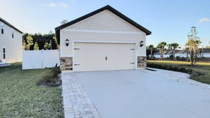
The Master-Planned Communities: Concentrated heavily around Oceanway, you will find newer, master-planned subdivisions. These are classic suburban environments built from the 2000s forward. They feature sidewalks, community pools, and modern construction. If you buy here, your maintenance burden looks like standard suburban homeownership. You will have municipal water and sewer. You will also likely have a homeowner association (HOA) and potentially a Community Development District (CDD)—a special-purpose local governmental entity that issues tax-free bonds to finance the neighborhood's infrastructure, which you repay via an annual non-ad valorem assessment on your tax bill. Always ask for the CDD debt service and operations figures in writing.
The Rural Acreage: Move away from the Oceanway core, and the parcels get large. This is where you find older established pockets and genuinely rural property. You can find room between houses here in a way that is simply impossible in the center of the county.
But buying acreage means you are buying the infrastructure.
The Infrastructure You Own
If you buy outside the master-planned grids, nobody is maintaining your sewer, because you probably do not have one. Or your water main, because you are likely on a well.
A significant percentage of the rural properties on the Northside operate on Onsite Sewage Treatment and Disposal Systems (OSTDS)—commonly known as septic tanks.
When you buy a house on septic, you own a miniature wastewater treatment plant in your yard. The city does not maintain it. You are responsible for ensuring the tank is pumped, the drain field is uncompacted, and the system is functioning.
The same applies to your water. Many rural Northside properties rely on private wells. There is no monthly JEA water bill, but there is also no municipal facility treating your water. The pump, the pressure tank, and the water quality testing are entirely your responsibility.
If your property sits on a tidal creek or the coastal marsh, you may have a dock. The State of Florida owns the submerged lands waterward of the mean high water line. Constructing or modifying a dock over those lands requires environmental and submerged-lands authorization, involving the Florida Department of Environmental Protection (FDEP) and potentially the U.S. Army Corps of Engineers. Do not assume you can build a dock just because you have water access; verify exactly what is permittable on the specific parcel before you buy it.
The Commute Tradeoff
This is the reality check we run with every buyer looking north of the river, and we are relentless about it.
The tradeoff for having space and land is the commute time.
If your job is located at Naval Air Station Jacksonville, Mayo Clinic, the St. Johns Town Center, or the Southside office parks, your morning drive requires crossing the city and navigating the bridge infrastructure.
I-95 and I-295 (the beltway) are your main arteries. Crossing the St. Johns River at rush hour is the single biggest time cost in this city. A gorgeous house on two acres does not help you at 7:45 a.m. when you are sitting in dead-stopped traffic on the Fuller Warren or the Dames Point bridge.
Measure your specific commute, at the actual hour you will drive it, before you commit to a Northside address. If you work from home or travel constantly out of JAX, this location is brilliant. If you have to be on the Southside at 8:00 a.m. sharp every weekday, you need to know exactly what you are signing up for.
The Due Diligence Profile
If you are buying a rural property on the Northside, a standard home inspection is just the baseline. You need specialized inspections:
Septic System: Hire a dedicated septic contractor. You want the tank pumped and inspected, the drain field evaluated, and the permit file pulled from the Florida Department of Health in Duval County to verify the system's age and legal capacity.
Private Well: Have the well water tested for bacteria and heavy metals. Have a well contractor inspect the pump, the casing, and the pressure tank.
Flood and Wind: The Northside is defined by its coastal marshes and the Trout and St. Johns rivers. Check the specific address at FEMA's Flood Map Service Center. An elevation certificate and a formal FIRM (Flood Insurance Rate Map) determination dictate your flood insurance premiums. Furthermore, coastal proximity means stricter wind mitigation requirements. Get an actual insurance quote on the specific address early in your inspection period.
Come Look at It With Us
The Northside rewards buyers who want room to breathe and are clear-eyed about the infrastructure that comes with it. We will tell you which questions to ask about the well, what the septic permits actually mean, and exactly what that morning drive to the Southside will look like.
#ForeverFamilyForeverHome
📞 Contact The Courtney Team
Still mapping the city? → Read our full guide to living in Jacksonville
The Courtney Team | Coldwell Banker Vanguard Realty | Licensed Real Estate Professionals in the State of Florida. Information in this guide is general and educational in nature and is not a representation about any specific property. Descriptions of onsite sewage treatment and disposal systems, private wells, Community Development District assessments, dock and submerged lands permitting, flood history, and flood zones are general explanations that change over time and vary by address — all of them must be independently verified for the specific property and the current year. Nothing here is legal, engineering, environmental, tax, or insurance advice; please consult a licensed attorney, inspector, marine contractor, or insurance agent, the Florida Department of Health in Duval County, the City of Jacksonville, the Florida Department of Environmental Protection, and FEMA as appropriate. Equal Housing Opportunity.