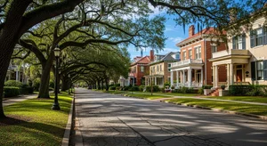
Walk San Marco Square on a Saturday morning and you'd bet money this is a protected historic district.
Mediterranean Revival storefronts around a triangular green. A fountain with three bronze lions. Streetcar-era commercial buildings from the 1920s. Oaks over everything. Listing sites and travel guides call it "the San Marco Historic District" so routinely that the phrase has the ring of fact.
It isn't one. Not at any level.
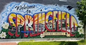
San Marco is not a locally designated historic district, and there is no San Marco district on the National Register either. Jacksonville has exactly three local historic districts — Springfield, Riverside Avondale, and St. Johns Quarter — and this isn't one of them. The City says so on its own Certificate of Appropriateness page.
That single fact changes more about buying here than anything else we could tell you, and it cuts both ways. You have freedom with your house that a Riverside owner doesn't. And the 1927 Tudor Revival down the street has considerably less protection than you'd assume.
Let's go through all of it — including the flooding, which is the other thing everybody asks about, and where there's genuinely good news for the first time in years.
New to the city? Start with our guide to living in Jacksonville, then come back.
First, the Part Everybody Gets Wrong
Here's the actual regulatory picture, because it's worth getting right before you buy:
There is no Certificate of Appropriateness requirement in San Marco. COAs apply in Jacksonville's three local historic districts and to individually designated Local Landmarks. San Marco has a limited number of those individual landmarks — but the neighborhood as a whole doesn't carry the requirement. If your property isn't one of the landmarks, you are not going through design review to replace your windows.
What does apply is the San Marco Overlay Zone. Adopted in 2005 after a run of demolitions, it sets standards for things like setbacks, height, lot subdivision and accessory structures, and its provisions override inconsistent zoning. It's a real constraint on what gets built.
But it is a zoning and form overlay, not a design review or demolition review process. That distinction is the whole story of this neighborhood's last twenty years.
The history of that, briefly, because it explains what you'll see
In the 1970s, when Riverside and Avondale pursued historic designation, San Marco wasn't interested.
In the 1990s the San Marco Preservation Society paid for a professional survey and assembled a list of contributing structures, aiming at National Register designation. The proposal ran into furious opposition from homeowners who saw it as an infringement on property rights. SMPS offered an opt-out window. Houses opted out.
One of them was 1922 River Road, a 1927 Tudor Revival. It was demolished in December 2016.
That demolition restarted the argument in 2017. Architectural historian Wayne Wood, who knows this city's building stock as well as anyone alive, put the loss at more than 25 landmark houses in twenty years and used the word "cancer." A City spokesperson confirmed on the record that because San Marco is neither a local nor a National Register district, demolition review would be limited to the handful of individual landmarks.
The 2005 overlay was the compromise position. It's still the compromise position.
What this means for you, practically:
If you're buying to renovate, you have latitude here that you don't have in Riverside, Avondale or Springfield. No COA, no monthly commission calendar, no application fee for exterior work. That's a genuine advantage and it's why some buyers choose this side of the river deliberately.
If you're buying because you love the streetscape, understand what's holding it up: an overlay that governs the form of new construction, and the choices individual owners have made. Not a designation that reviews demolitions.
Either way, verify the specific address. Whether a given property is an individually designated Local Landmark, and exactly how the overlay applies to a particular lot, are questions for the City's Planning and Development Department — not for a blog post and not for your agent. We'll tell you who to call. We won't interpret the zoning code for you, because that isn't our lane.
→ More on how Jacksonville historic designation actually works
This Side of the River Is Older Than Downtown
Genuinely. Not by a little.
The Cow Ford — the narrow crossing the whole city is named for — had a ferry running by the 1760s, and the ferry landing was on the south bank. When Spain took Florida back in 1783, they built Fort San Nicolas beside that landing. The fort was abandoned by 1817, but the name stuck and anglicized, which is why the neighborhood east of San Marco is called St. Nicholas today.
In 1793 the Spanish issued a land grant here that eventually passed to Isaac Hendricks. That's Hendricks Avenue.
By 1820 the families living between the Cow Ford and the abandoned fort petitioned the Spanish governor to establish a township — two years before anybody surveyed the town on the north bank that became Jacksonville.
And for twenty-five years in the twentieth century, this was a different city. South Jacksonville incorporated in 1907, with a population around 600 and no paved streets, sidewalks or electric lights. It had its own mayor and its own city hall. In 1932, voters in both cities approved annexation, and South Jacksonville became part of Jacksonville — thirty-six years before the countywide consolidation.
The former South Jacksonville City Hall still stands on Hendricks Avenue. It's been restored, and it's now the headquarters of the San Marco Preservation Society. There's a nice symmetry in that.
Then Telfair Stockton Bought a Ruined Estate
If you read our Riverside and Avondale guide, you've met this man already. Stockton developed Avondale in 1920. In 1925 he came across the river and did it again.
He bought 80 acres of the decayed Villa Alexandria estate and the old Gamble & Stockton brickyard, platted 250 lots, and put them on the market in September 1925 at the peak of the Florida land boom.
Every lot sold in three hours. Before meaningful construction had begun.
Stockton had recently traveled to Europe, and he named the development for the Piazza San Marco in Venice. The plan was Italian Renaissance Revival throughout — hence the name, several of the street names, and the Square.
Then reality happened. The style was already falling out of fashion, the land boom collapsed, and buyers built what they wanted. The result is a neighborhood that's Venetian in name and square, and cheerfully eclectic in its housing. Mediterranean Revival is here, concentrated in and near the Square. So is Tudor Revival — the house demolished in 2016 was a 1927 Tudor, and it wasn't the only one. So is Colonial Revival. The Square's Art Deco arrived in the 1930s.
The honest characterization isn't a style. It's that most of these houses went up in the 1920s and 1930s with real architectural pedigree and no unifying plan.
One earlier chapter worth knowing: between Hendricks and Kings Avenue sits Fletcher Park, a federal World War I housing project built in 1918–19 for workers at the Merrill-Stevens shipyard. 158 houses, completed in April 1919, with Henry John Klutho, Mark & Sheftall, and Mellen Greeley all on the design. Most of it survives, and it predates Stockton's subdivision by seven years. It's one of the most under-told pieces of housing history in the city.
St. Nicholas Is a Different Neighborhood
It sits immediately east of San Marco, and people conflate the two constantly.
Here's the inversion that makes it interesting: St. Nicholas has the older name and the newer houses. The name goes back to a 1783 Spanish fort. The housing mostly went up in the 1930s and 40s, finishing out by the 1960s — later than core San Marco, with no developer master plan and no overlay zone. The stock runs more modest and more mid-century, which for a lot of buyers is exactly the point.
It has its own commercial node: St. Nicholas Town Center at Atlantic and Beach, built out 1949 to 1957.
A few things there worth knowing:
Palmer Terrace holds 1880s houses, including an 1886 residence — among the oldest standing near downtown.
The historic St. Nicholas Cemetery dates to the 1840s, with headstones going back to 1849.
The restored St. Nicholas train depot, relocated to a park in 2004, was used by Zora Neale Hurston.
Midtown Centre, opened by Ira Koger in 1957, is credited as the first suburban office park in the United States. It's still there, now over thirty buildings.
Bono's, founded near Kings and Atlantic in 1949, is Jacksonville's second-oldest continuously operating barbecue.
The Square, and What's Around It
San Marco Square is the triangular commercial district where Atlantic Boulevard, Hendricks Avenue and San Marco Boulevard converge — a junction that exists because the city's two old streetcar lines crossed near there.
The San Marco Building, completed 1926–27 by Marsh & Saxelbye, was the first commercial building on the Square and set the arched, tile-roofed tone everything else followed.
The lions are newer than they look. The original fountain at the Square was compass-themed and was demolished during the neighborhood's rough patch in the 1970s. The three bronze lions went in during the City's renovation of the Square in 1997, designed by Angela Shiffanela and Alan Wilson. They're an homage to the Piazza San Marco, not copies of Venice's winged lion of St. Mark. Anyone who tells you they're original or they're replicas is wrong on both counts.
Balis Park is the green in the middle of the Square, and its origin is a good one. The parcel held a 1927 Spanish-style Gulf service station. The City bought it in 1984, and the park was built with funding from Abla Balis in memory of her husband Sheffield, longtime San Marco residents. Dedicated January 1988. The gazebo hosts the annual tree lighting. A 2013 project rerouted streets to expand the green.
Theatre Jacksonville, at 2032 San Marco Boulevard, is the real landmark most people walk past. The company was founded in 1919 and is the oldest continuously operating community theater in Florida — and among the oldest in the country. The building, financed by cigar magnate Carl Swisher and designed by Ivan H. Smith, opened in 1938 and is on the National Register.
The other 1938 theater — the Art Deco San Marco Theatre, credited to Roy Benjamin — ran as a single-screen cinema for 84 years and closed on January 1, 2023. The building and its facade were kept; it reopened in June 2025 as Electric Dough Pizza Co. Don't go looking for movies.
On the Southbank, and a correction
The Southbank — the riverfront strip north of I-95 — is legally part of Downtown, not San Marco. It was folded into the central business district in the 1980s and is governed under the Downtown overlay. People say "San Marco" and mean the Southbank all the time; the City doesn't.
What's there:
Baptist Health and Wolfson Children's Hospital on Prudential Drive. Baptist Health describes itself as the area's largest employer.
Friendship Fountain, back in operation after a multimillion-dollar renovation, with a new nautical-themed playground at St. Johns River Park that opened in April 2025.
The Southbank Riverwalk, roughly 1.2 miles, with an extension under way to connect Baptist to the Fuller Warren shared-use path.
The Treaty Oak in Jessie Ball duPont Park — a live oak of more than 200 years, and a wonderful piece of fiction. No treaty was ever signed there. In the 1930s a Times-Union reporter named Pat Moran invented the story of settlers and Native Americans making peace beneath it, specifically to make the tree too famous to cut down. It worked. The surrounding land was purchased at Jessie Ball duPont's request and donated to the City in 1964.
⚠️ And the one to update in your head: MOSH is gone from the Southbank. The Museum of Science & History closed there on September 1, 2025, and the building has been approved for demolition. The new museum is going up on the Northbank at the Shipyards, with reopening currently targeted for 2029 — a date that has already moved once, so check before you plan around it. Any guide still placing MOSH on the Southbank is out of date. Including, until recently, ours.
The Practical Reality
Flooding, and the $42.5 million project
This is the honest conversation, and it's the one that matters most here.
San Marco floods. The reason is geography. The neighborhood sits shaped like a bowl — water collecting in the middle of it has no easy path to the river. Add tidal influence, which on the St. Johns can reverse the river's flow for well over a hundred miles upstream, and a king tide or onshore wind can block drainage and push water back up while rain is still falling.
Hurricane Irma in September 2017 produced the worst flooding in the city's recorded history. Homes in San Marco flooded. A section of San Marco Boulevard stayed underwater afterward. The documented trouble spots were LaSalle Street at Hendricks Avenue, and Hendricks north from Landon Avenue.
It kept happening. Ian in 2022 closed roads — Palm Avenue and LaSalle — though reporting at the time noted homes and businesses were largely spared and it was clearly milder than Irma. Nicole later that year and Milton in 2024 both brought tidal flooding forecasts for San Marco specifically. In September 2024, flooding was bad enough that the City installed four temporary pumps and a Council member publicly demanded answers from Public Works.
Here's what changed, and it's substantial.
The City built the LaSalle Street Pump Station and San Marco drainage project — a $42.5 million job by Jacksonville-based Haskell, engineered to move water off the land and back into the river.
Phase 1, the pump station itself, came online in early 2025. Capacity: nearly 70,000 gallons per minute, with pumps built below the water table.
Phase 2 laid roughly 5,000 feet of new large-diameter gravity pipe tying the neighborhood into the pump station. Construction ran from April 2025, closed the San Marco Boulevard and LaSalle intersection for a stretch, and the final gravity segment was completed in late March 2026.
Hardscape restoration at Riviera and San Marco Boulevard wrapped in May 2026, with landscaping following. Trees that came out were replaced with larger-than-standard specimens.
What we will not tell you is that this fixed it. The City hasn't said that, and neither will we. Monitoring is continuing through weather events for additional improvements. What we'll say is that a pump station and five thousand feet of new drainage pipe now exist where they didn't in 2017 — and that after a decade of this conversation going one direction, something substantial finally got built.
What you should do regardless — and here the address matters more than the neighborhood:
The whole point of a bowl is that the rim and the bottom are different places. Two houses four blocks apart can have completely different histories, and this is a neighborhood where you want the specific answer, not the general one.
So: pull the address on FEMA's Flood Map Service Center, which is the official map, and take official determinations and elevation certificates from the City's Development Services office rather than from a flood-score website. Then get an actual insurance quote on that address, from a licensed agent, early enough in your inspection period that the answer can still change your mind. Ask the seller directly whether the house has taken water, and when.
That last question is the one people forget to ask, and it's usually the most informative.
Where our job ends: we'll tell you which streets have shown up in the reporting and which questions to put to whom. We won't tell you what zone a house is in, whether you need flood coverage, or what it will cost. Not our license.
Getting across the river
Three bridges connect this side to Downtown: the Acosta, the Main Street Bridge, and the Fuller Warren, which carries I-95 and is your Southside and interstate connection. The Skyway crosses on the Acosta, with a San Marco station on the Southbank.
The Acosta has a story, and most people get its name wrong. The bridge that opened here on July 1, 1921 was the St. Johns River Bridge — a three-lane steel vertical-lift toll bridge, Florida's first, nicknamed the "Yellow Monster." Tolls came off in 1940. It was renamed for city commissioner St. Elmo W. Acosta in 1949, and the current span replaced it in the 1990s. It also finished off the ferry service that had been crossing here since the 1760s.
We're not going to quote you drive times. Drive it yourself, on a weekday, at the hour you'd actually be driving it. That advice doesn't change.
Old houses
Most of this stock is 1920s through 1940s, and the same rules apply here as anywhere with houses that age. Hire an inspector who works on older homes rather than whoever the lender suggests.
The things we pay attention to on a house of this era: original or partially updated wiring, cast iron waste lines and galvanized supply lines, original windows, foundation and crawlspace condition, additions of uncertain permit history, roof age, and HVAC retrofitted into a house built without ductwork.
And given everything above — grade, drainage, and where the house sits relative to the street. That matters more in this neighborhood than in most.
One federal item that applies to essentially all of this housing stock: sellers and landlords of homes built before 1978 must disclose known lead-based paint and hazards, provide the EPA pamphlet, and give you the opportunity to conduct your own inspection. Note what that requires — disclosure of what's known, plus your right to inspect. It does not require the seller to test.
We flag what we see. Your inspector is the one who's licensed to tell you what it means.
Look Here If
You want a walkable square with restaurants and shops at the end of your block, a 1920s house with real architectural lineage, and one of the shortest drives into downtown of any established neighborhood here. You'd like room to renovate without filing for design review. And you're willing to do serious homework on drainage and elevation for the specific address, rather than assuming the neighborhood answer applies to your house.
Lean core San Marco for the Square, the 1920s and 30s stock, and the overlay's standards on what gets built next door.
Lean St. Nicholas for later and smaller-scale houses and less of the Square's weekend traffic.
Neighboring Options
Riverside and Avondale — across the river, same era, same developer in Avondale's case, and the opposite regulatory situation. If design review sounds like protection rather than paperwork, look there instead.
Springfield — north of downtown, locally designated, more Victorian, more of the inventory mid-restoration.
Building new instead? → Our new construction buyer guide covers how builder representation works here and why you register your agent on the first visit.
The San Marco Preservation Society
SMPS is the neighborhood organization, headquartered in the restored South Jacksonville City Hall on Hendricks. They ran the 1990s survey, pushed for the overlay, and maintain an advisory smart-growth plan for North San Marco. They also operate Preservation Hall, a former Episcopal church in Fletcher Park, as a reservable event space.
San Marco turned 100 in 2025, and SMPS ran a full centennial program for it. Worth knowing if you're trying to get a feel for how organized the neighborhood is: very.
Their working definition of the neighborhood is I-95 to the north, Philips Highway east, Greenridge Road south, and the river west. Like all neighborhood boundaries here, it's unofficial and it has moved over time.
Renting First
If you're relocating and not certain yet, renting a year in San Marco teaches you two things fast: whether you actually want a house of this vintage, and how your street behaves in a hard September rain.
We manage residential rentals across the Jacksonville metro.
→ See our property management services
Frequently Asked Questions
Is San Marco a historic district? No — and this surprises almost everyone. San Marco is not a locally designated historic district and there is no San Marco district on the National Register. Jacksonville has three local historic districts: Springfield, Riverside Avondale, and St. Johns Quarter. What San Marco has is the San Marco Overlay Zone, adopted in 2005, plus a limited number of individually designated Local Landmarks.
Do I need a Certificate of Appropriateness to renovate in San Marco? Not unless your specific property is an individually designated Local Landmark. COA requirements apply in the three local historic districts and to local landmarks. Verify your address with the City's Planning and Development Department rather than assuming either way.
What does the San Marco Overlay Zone actually do? It sets zoning standards for new development — things like setbacks, height, lot subdivision and accessory structures — and overrides inconsistent zoning provisions. It is not a design review or demolition review process. How it applies to a particular lot is a question for City Planning.
Does San Marco flood? Parts of it have, significantly. The neighborhood sits in a bowl and is subject to tidal influence from the St. Johns. Hurricane Irma in 2017 produced the worst flooding in the city's recorded history, with documented problems at LaSalle and Hendricks and along Hendricks north of Landon. The City has since completed a $42.5 million drainage project including a pump station moving nearly 70,000 gallons per minute. The City has not said this eliminated flood risk, and neither do we — monitoring is continuing. Check the specific address against FEMA's flood maps, and get a real insurance quote from a licensed agent early in your inspection period.
Is the Museum of Science & History still on the Southbank? No. MOSH closed at its Southbank location on September 1, 2025, and the building is being demolished. The new museum is under construction on the Northbank at the Shipyards, with reopening planned for 2028.
Is the San Marco Theatre still a movie theater? No. It closed as a cinema on January 1, 2023, after 84 years. The building and its Art Deco facade were preserved and it reopened in June 2025 as a pizza restaurant. Theatre Jacksonville, a separate building at 2032 San Marco Boulevard, is still very much operating — it's the oldest continuously operating community theater in Florida.
Is St. Nicholas part of San Marco? No. St. Nicholas is its own neighborhood immediately east of San Marco, with a name dating to a 1783 Spanish fort and housing that mostly went up in the 1930s and 40s — later than core San Marco.
Was San Marco really a separate city? The area was. South Jacksonville incorporated in 1907 with its own mayor and city hall, and was annexed into Jacksonville in 1932 — thirty-six years before the countywide consolidation. The former South Jacksonville City Hall still stands on Hendricks Avenue.
Come Look at It With Us
We'll walk you through which blocks sit high and which sit low, what the overlay does and doesn't protect, and which questions to put to the City before you write an offer.
Tell us what matters — the walk to the Square, the room to renovate, the drainage, the drive downtown — and we'll give you straight information on every block that fits, including the ones we don't have a listing on.
#ForeverFamilyForeverHome
Still mapping the city? → Read our full guide to living in Jacksonville
The Courtney Team | Coldwell Banker Vanguard Realty | Licensed Real Estate Professionals in the State of Florida. Information in this guide is general and educational in nature and is not a representation about any specific property. Descriptions of historic designation, the San Marco Overlay Zone and other zoning provisions, flood history and flood zones, drainage infrastructure, and insurance are general explanations that change over time and vary by address — all of them must be independently verified for the specific property and the current year. Nothing here is legal, zoning, tax, or insurance advice; please consult a licensed attorney, insurance agent, or tax professional, the City of Jacksonville Planning and Development Department, the City's Historic Preservation Section, and FEMA or City of Jacksonville Development Services as appropriate. Equal Housing Opportunity.